What a Magical Day at Easter Island!


Easter Island as known as Rapa Nui is the southernmost island of the Polynesian triangle. It is one of the most isolated inhabited islands and therefore hard to reach because of the large swells that batter the island. Therefore the tender service took an hour longer than usual to get us ashore, but luckily our time was extended here!
We anchored at 6am and we were originally supposed to get off the ship at 8am, but we were delayed since it was still dark! Easter Island is on Pittsburgh time - in the middle of the Pacific! The ship was anchored to access a sheltered beach at the north end of the island instead of the south because of the large surf. When we took the tender over, in order to reach the shore, they had used another lifeboat as a barrier to the shore. Therefore we had to exit our boat, walk through another boat, then drop down about 3 feet onto a platform that was moving in the water because of the waves. It was crazy! Finally we reached shore!
We were on a private tour and our tour guide was the granddaughter of the American archeologist, Dr. William Mulloy, who came to Easter Island and started the resurrection of the statues! He dedicated his life to this restoration and his cremated remains are buried in a special memorial site on the island.

Our tour guide has been on the island for 15 years and knew so much information. Easter Island was given the name Easter because it was discovered by the Dutch on Easter Sunday in 1722. Easter Islanders claimed that Chief Hotu Matu'a arrived on the island in a large canoe with his wife and extended family although the time period varies from 300-400AD to 700-800AD. This date range is based on glottochronological calculations and on three radiocardon dates from charcoal that appears to have been produced during forest clearance activities.
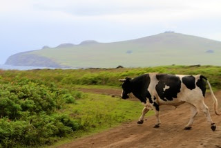
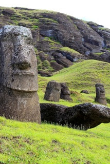
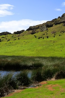
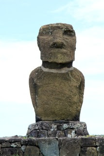
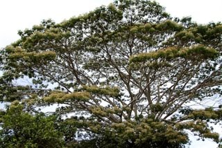
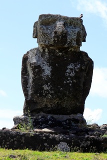
Easter Island is widely famous for its 887 extant monumental statues, called Moai, created by the early Rapanui people. The large stone statues were carved from 1100 - 1680. Although often identified as Easter Island "heads," the statues are actually complete torsos but some upright Moai have become buried up to their necks by shifting soils. Easter Island is void of trees but rather is covered with low grasses. There is also wild horses running all over the land and cows roaming all over the dirt streets. The ride from the pier was on dirt roads that where very bumpy rock covered and potholed filled!


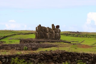
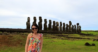
Our first stop was at Ahu Tongariki. This is noted to be the largest monolithic monument in all of Eastern Polynesia. This amazing platform hold 15 of some of the largest statues on the island.

With the surrounding sea cliffs and beautiful ocean background Tongariki is truly one of the most incredible sites on the island.


Each statue is a different individual both facially and in height and size. We were told that the statue's hair is where the power was and the natives kept their hair long and tied up on their heads.


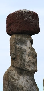
Originally the statues wore hats or top knots, but only one had a top knot here and on the ground nearby there were other top knots lying down. The volcanic stone, Red Scoria, was used for making the Pukao or top knot. These topknots were found placed on top of heads of some of the largest statues on the island.


Our next stop could very well be one of he most amazing sites in the world. The volcano of Rano Raraku is also known as the statue factory.

It was from the volcanic stone of Rano Raraki that 95% of all the statues on the island were carved. There has been counted some 397 Moai at Rano Raraku.

Some were completely finished and left waiting on the slopes of the volcano for there transportation while others are at various stages of completion still connected to the molten rock of the volcano.

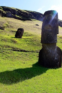


We saw some amazing Moai situated in the hillside.


There was a kneeling Moai, the only one on the island.

There was the largest Moai here of 21 meters, but it is still embedded in the hillside.


We also saw Moal embedded in the ground as well as parts of the hillside erected away were the Moai were craved from.

We then had the opportunity to hike to the top of the volcano to see the beautiful crated with its fresh water lake. The red colored rock was magnificent! I was a wonderful hike and an amazing view!


We then went to one of the most spectacular points of origin, Rano Kao, which is the southwestern volcano near the airport. Rano Kau is one of three principal volcanoes which created the island. It is approximately 2.5 million year olds and has the larger caldera of any volcano on the island measuring 1.6 kilometers in diameter. Its steep slopes lead to a lake - filled crater which is covered with a type of bulrush reed which is also found in Lake Titicaca in Bolivia. Also clung to the steep slopes of Rano Kao is the ceremonial village of Morongo which is one of the most visually spectacular sites on the island.

One the one side of the village, you see the beautiful caldera of Rano Kau. This was stunning!


The blue green of the water mixed with the mosses and grasses was so spectacular to see and hard to capture!

On the other side you see the ocean and the mysteries islets of Motu Nui, Motu Ri and Motu Kao Kao.


It was these islets in connection with the village of Orongo where the amazing ancient Tangata Manu or Birdman Ceremonies were held. The ruins of Orongo have the houses where the chiefs stayed. There are these incredibly small doors that open into a very small one room hole where the chiefs would stay.


Orongo is also one of the best sites to view the petroglyph carvings of the island.
This site is yet another site restored by Dr. Mulloy in 1976.


Then we went to the Ahu Tahai complex where we saw more of the most amazing statues! Here we saw three restored alters or AHU with a total of 7 statues re-erected on top.


Aside from the ceremonial aspect we saw the only Moai with the coral eye inlay.


Also in this complex there was the living village with canoe ramp, house foundations, cave dwellings and chicken houses!
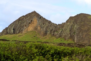
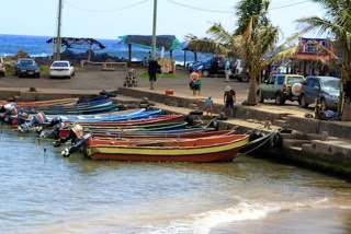
Some of our sights we saw along the way!


There were some interesting sights we saw as well as the ranchers herding the horses across the roads!


Our last stop of the day was at Anakin. Anakena is the larger of only 2 white sand beaches that are found on the island.


It is the legendary landing spot of the first king, Hotu Matua, and noted to be the center of the royal clan territory called the Miru. Here we had the opportunity to see the restored Ahu.


The Ahu Ature Huke with its single Moai is noted to be the very first Moai on the island to be re-erected on top of its Ahu.
This was done not by the archeologists, but by the islanders themselves in order to prove that they had retained the knowledge of how to move the Moai. The Ahu Nau Nau has some of the most "perfect" Moai of any restored Ahu of the island.

This is because the Moai of this Ahu were completely covered by sand. The sand protected all the fine detailed carving of not only the faces of the statues but also of the decoration on their backs.


We sat at the huts along the water, eating fresh mini pineapple! It was a great ending to a perfect day!


No comments:
Post a Comment